|
|
|
Last Updated: January 16, 2023 |
Introduction
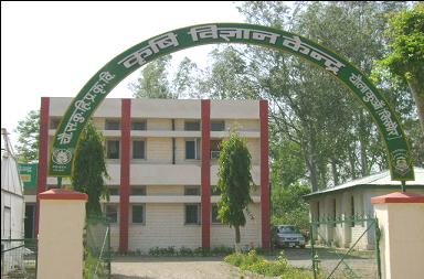
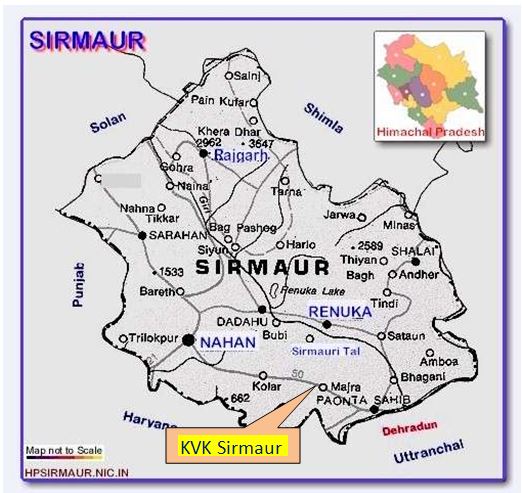
Krishi Vigyan Kendras (Farm Science Centre), an innovative science based institutions, were thus established mainly to impart vocational training to the farmers , farm women and field level extension workers. The concept of vocational training in agriculture through KVK grew substantially due to greater demand for improved agricultural technology by the farmers. They not only required knowledge and understanding of the complexity of technologies, but also progressively more and more skills in various complex agricultural operations for adoption on their farms. The effectiveness of the KVK was further enhanced by adding the activities related to on-farm testing and Front-Line Demonstration on major agricultural technologies in order to make the training of farmers location specific, need based and resource-oriented. It acts as a conduit between the university researchers and farming community of the area. Krishi Vigyan Kendra, Dhaulakuan, Distt. Sirmour was established in February, 1983 under the control of Directorate of Extension Education CSK HPKV, Palampur (HP). It is located 25 km away from district headquarter at Nahan-Paonta road (NH 72). It is situated on 300 04’ N and 750 05’ E at an elevation of 468 m above mean sea level. It is about 105 km from Chandigarh and 60 km from Dehradun on NH 72. Nearest railway stations are Dehradun (60 km) Ambala Cantt (100 km), and Chandigarh (105 km). District Profile District Sirmour is located in outer Himalayas, which is commonly known as Shivalik range . Like other parts of Himachal Pradesh, it has beautiful landscapes, and refreshing climate. The district lies between 300 22' 30" to 31.0 01'20" north latitudes and 770 01' 12" to 770 49' 40" east longitudes. The district is predominantly mountainous with deep valleys lying between Shivalik ranges of varying elevations. The River Giri, a tributary of the river Yamuna, is the biggest river in Sirmaur district. Flowing in the south-east direction, it bisects the district in two parts, namely, the Trans-Giri area and Cis-Giri area. Located on the southern most portion of Himachal Pradesh, Sirmaur district is bounded by Shimla district in the north, Solan district in the north-west, state of Haryana in the south and west, while the state of Uttrakhand makes its eastern boundary. The district has a total area of 2,825 sq. km. which covers 5.07 percent area of the state. Geographically, the district can be divided into three parts i.e. the Trans-Giri (Giri Par) region, Cis-Giri (Giri War) region and Plains of Kiar-da-dun or Dun Valley. The Trans-Giri region consists of mountains culminating into the Chur peak which is popularly called as Chur Chandni Ki Dhar (the hill of silver bangle). It has an altitude of 3,647 meters above the sea level. From this lofty mountain, two ranges emerge one in the north-west direction called Dhar Taproli-Jadol and the other Dhar Nohra which runs south-east direction towards Haripur Fort at an altitude of 2,677 meters above the mean sea level. The district have a variety of climate varying according to elevation. Summer months are exceedingly hot in Dun and water is scarce. The hilly areas have a temperate climate though the Dharthi range is hot. The Trans-Giri tract, Pajota and Sain range areas are comparatively cool even in summers. Snow falls regularly in winters in Trans-Giri areas, whereas in Sain ranges it is occasional, while in Dharthi ranges it is rarely noticed. Climate of Dhaulakuan is variable with temperature dipping -0.50C in winter and touching even 450C during summers Geographic and Demographic Features of Sirmour District
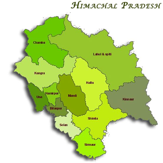
Maps of HP and Sirmour
|
|
|